We as a family have a tradition of camping on Thanksgiving, and have for over 30 years. Due to "life" we can't go this year so I'm on another solo trip the week before.
In the meantime I've a little poem to share.
As I twiddle my thumbs and prognosticate,
On the camping trip
for which I can't be late.
Just the thought of it
sends my heart all atwitter.
Oh how I love thee,
My little Outfitter.
There, now the goofiness is over and I feel better, for the moment. Hey, you try to get Outfitter to rhyme with something!
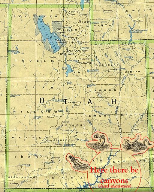
Looking for cliff dwellings is a fun thing to do, so I'll need an old map.
The first quick stop was Monument Valley, always a butte to see.

As I passed the rock called Mexican Hat, and the town named the same, I wondered why they call it that?

Ok, I was goofin there.

Driving around behind the "hat" there are some multi-colored hills that remind me of dessert, like some kind of marble fudge cake maybe.
 
The hat from the backside.

Looking out over the San Juan River north of the town Mexican Hat.
 
By the way, did I mention there are LOTS of pictures? I apologize up front here. Maybe you friends in the cold north country will feel warmer looking at them.

For the first night I was making tracks for Butler Wash, just west of Bluff, Utah. Butler runs along Comb Ridge, a neat monocline with tons of smallish canyons and lots of ruins. I made it just before sundown.
As I spent the first night in the Outback I had to laugh at myself. I was watching Ironman on my little flat screen to the light and heat of my new Wave 3 heater. How tough camping is compared to the people who's dwellings I was looking for. The Wave 3 install was copied from a real nice guy on the Outfitter website and I am real happy with it!

The first thing I saw in the morning was what is left of the old Mormon "Honeymoon" trail to St. George, Utah. These folks were into marriage in a big way and put lots of work into getting there. But I have to ask, what's wrong with Vegas? I mean there's already a major road to get there and everything...

Lower Butler Wash in the morning.

Walking up the wash I was looking for petroglyphs. Specifically the "Wolfman" panel. Wasn't he in American Graffiti? Must be really old by now, him and...Dick Clark. There was water in the wash there and to cross you had to find a beaver dam to walk over. I felt like knocking to see if anybody was home.

A wee bit of walking took me there. I put myself in these pictures for scale. Maybe I should call them "Old Man Walking" Panel or something.
 
It's named Wolfman Panel for the 2 paw prints on either side of the panel. At least that's what my paw told me.

And yes, those are bullet holes in the panel. They look quite old and I figure they may have been put there by some old cowboys back before the pictographs meant anything to most people. At least that's my story.

Of course some of the images are open to interpretation. Is that an Anasazi happy face on the left??

1st petroglyph of a kid saying "Hi Mom!"

Later in the day I was getting skunked (not like Bear, see previous trip report) looking for some major ruins. No marked trailheads to get a guy started or anything. So I climbed Comb Ridge for lunch. My wife told me last week she's signed us up for another marathon, our second, and I figure today is the first day of training. What a climb! And the views are of forever.

This is why the quads were on fire. This monocline is definitely no patsycline!

The San Juan Mountains of Colorado were in the far distance.

Looking south I saw the highway and barely in the distance to the right, Monument Valley.

Looking north towards Natural Bridges National Park, somewhere along the band of cliffs in the distance is where I'll spend tomorrow night.

The next day I was still looking for those darn ruins. While traipsing thru some tall brush I startled and was startled by 3 Godzilla size turkeys, between 5 & 6 ft. tall! I mean when they poked their heads up to look at me we were almost eye to eye and I was thinking...RUN! I was also thinking the Pilgrims landed on the wrong side of the country for Thanksgiving as these 3 birds would have feed them all winter. Not being able to get their picture, I took one of their tracks.

And finally, there they were, looking like the home of monarchs under the cliff.
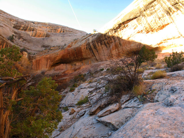 
Getting over to them was a thrill, having to walk a narrow band of rock. The folks that lived here must not have had good Tevas and so had to chisel little traction holes in the rock.
 
As I hiked to more ruins I was trying to think like the Ancient Indians, walk quietly like they did. In other words get in the Anasazi frame of mind. My Indian underwear too, was getting in on the act, as it quitely creeped up on me from behind. I wish it would stop that. (No, no picture.)
The next set of dwellings where on a smaller scale, but the appearance in photographs is amazing. Due to a trick of the light and my superior knowledge of photography I was able to capture the look of the flaming roof. By the way, I think my f-stop doesn't work as it goes straight to "g." I'll have to buy a new f-stop I guess.
 
Bumbling down a road I had picked off the topo map you never really know what to expect. I was hoping for an overlook to Comb Ridge, and boy was I impressed. I had lunch yesterday on one of those peaks in the distance!
 
Talk about a room with a view...
 
And just what does Whazoo do with his time you might ask...he entertains himself of course.

While sitting there having an evening beverage I noticed just across the way, ruins I didn't even know were there. What an excellent bonus to this road. These are tower type dwellings.

Thinking like an Anasazi I was wondering about water as none is close. With a little bit of exploring I found a crack in the rock, that lead to water...and more ruins. As I climbed down, it just kept getting better all the time.
 
In fact the whole area under the towers leaked water.

Views from the towers to the truck.
 
These dwellings were right under my camp spot, who knew?

Looking at the inside of the walls I saw 800-900 year old handprints where they packed the mud into the rock walls. I never knew history could be so "hands on."

When I saw this entry I knew it was the women's restroom. So that's where McDonalds got their women's room sign, don't you think?

I figured this was the mens water closet, with toilet paper still available.

A few other views of these and one other set of dwellings.
    
So far on this trip I was feeling blessed and lucky. Like I had my little lucky charm working for the Whazoo. In fact...I brought my own lucky charm in hopes it would work.

From there I went up White Canyon to Cheesebox Road. After 3 hours of hiking 1 way, I did reach the ruins in that area, only to run out of time to get down to them, but here are a few pictures of the area.
  
Setting up for an evening fire I was amazed at how quickly it got cold just after the sun went down. I mean it went from 70 to 69 in about a second, causing me to put on a sweater, the result of many years living in Phoenix. I could no longer be an Anasazi. Just so you know, it did hit 30 degrees in the night and thanks to having 2 heaters, I did survive.
Next stop, yes there is more, was North Wash, above Lake Powell. A spot visited before in a Jeep, AND, the 1 place in mind when I bought this wonder truck and camper. I was finally back to spend the night. The Henry Mountains were behind me on the way in.
 
We have camped at the base of the distant pass, on our way Jeeping to the Maze District of Canyonlands, and looked this way, knowing the view that was here.
          
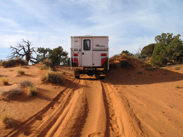
The road degraded to sandy jeep road, and gave reason for my hesitating pulse on some hill sections on the way out.
Going south after 1 night on the edge of the known world, I was entering Whazoo Canyon.
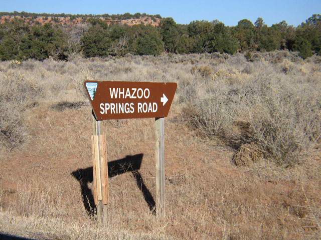
(After seeing trip reports with much signage, I was wanting to get in on the act!)

In the land of many canyons, the bridge over the Dirty Devil Whazoo River looks futuristic and out of place, yet very very cool. Where are the Jetsons?

NEXT STOP, 2nd to last, are we glad?
A beautiful evening before another great walk-about.
Now those are were cliff dwellings, oh yeah, what a "wow" factor! And a real booger to get to. Look just below the very top rock for the dwellings. In this picture what doesn't show is that the knoll the ruins are on, are not part of the canyon wall behind them. You'll see..
  
Those granaries, for the ruins maybe, a person could walk over and not know they were there if you came in from any other direction. My Lucky Charms were still working.

This "bridge" is necessary to cross, just don't look down.
 
Check out the evenness of the rocks! Those folks were good builders. And I'm thinking that as they sat up here and read their novels of intrigue, well they were called "cliff hangers." (Sorry for that)

Where's pizza delivery?

Wood lintels still in great shape. A testament to dry climate.
 
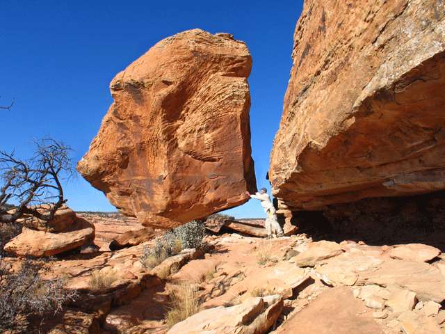
I've always wanted to tip a huge boulder, now's my chance.
Looking at the bridge back.

And the climb up, no slipping allowed.

Now for the last stop, I promise, no really. I almost always hit Muley Point looking over Monument Valley. And strange, but last time here the view was clouded by haze from california fires. This time as well, the Lucky Charms must be wearing thin and it's time to go home.
 
The top of the Moki, I mean Whazoo Dugway is the way down from the canyons.

The view on a better day...Valley of the Gods to the distant left. And believe it or not, a bed & breakfast down just below me. I carry my B&B with me, as do all us truck campers.

So I'm hoping this wasn't too much of a report, the scenery was fantastic and the pictures took themselves. I have so much respect for those people and their very hard lives, as I camped in truck camper luxury, and I will try not to complain so much for my hard times. Hopefully all the pictures haven't "ruined" you, next time maybe some slot canyons.
Thanks for reading,
Dave Rogers
Originally posted on rv.net 11/26/08 |

Sunday, March 1, 2015
Outfitter to the outback...of Utah

Subscribe to:
Post Comments (Atom)
No comments:
Post a Comment